British Western Pacific Territories
| Alliance | Allies - Minor Member Nation or Possession | |
| Possessing Power | United Kingdom |
Contributor: C. Peter Chen
ww2dbaseBritish Western Pacific Territories was established in 1877. It encompassed British colonies in the Pacific Ocean. It included the Canton and Enderbury Islands, Cook Islands, Fiji, Gilbert and Ellice Islands, Nauru, New Hebrides, Savage Island, Pitcairn Islands, Solomon Islands, Tonga, and the Union Islands. During the war, many of the islands were occupied by the Japanese, some of which such as Solomon Islands and Gilbert Islands saw a number of major battles during the war.
ww2dbaseSir Harry Charles Luke was the appointed High Commissioner for the British Western Pacific Territories between 16 Sep 1938 and 1942. Between 1942 and 1945 the position was suspended as the territory was governed by the British military during war time. Sir Alexander William George Herder Grantham was appointed the High Commissioner after the war.
ww2dbaseMost, but not all, of the islands were given independence by the 1970s, thus the British Western Pacific Territories was abolished on 2 Jan 1976.
ww2dbaseSource: Wikipedia
Last Major Update: Jun 2010
| People | ||
| Vouza, Jacob | ||
| Events Taken Place in British Western Pacific Territories | ||
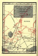
| Guadalcanal Campaign | 7 Aug 1942 - 9 Feb 1943 | |
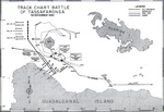
| Solomon Islands Campaign | 23 Aug 1942 - 25 Dec 1943 | |
| Facilities | ||
| Henderson Field | Air Base | |
| Kahili Airfield | Air Base | |
Weather
WW2-Era Weather Data for British Western Pacific Territories
Photographs
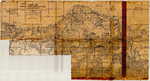
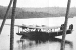 | 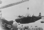 | 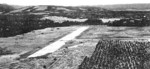 | 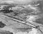 |
 |  |  |  |
British Western Pacific Territories in World War II Interactive Map
Did you enjoy this article or find this article helpful? If so, please consider supporting us on Patreon. Even $1 per month will go a long way! Thank you. Share this article with your friends: Stay updated with WW2DB: |
- » Wreck of USS Edsall Found (14 Nov 2024)
- » Autumn 2024 Fundraiser (7 Nov 2024)
- » Nobel Peace Prize for the Atomic Bomb Survivors Organization (11 Oct 2024)
- » Wreck of USS Stewart/DD-224 Found (2 Oct 2024)
- » See all news
|
- » 1,150 biographies
- » 337 events
- » 43,917 timeline entries
- » 1,241 ships
- » 350 aircraft models
- » 207 vehicle models
- » 375 weapon models
- » 123 historical documents
- » 260 facilities
- » 470 book reviews
- » 28,560 photos
- » 432 maps
Winston Churchill
Please consider supporting us on Patreon. Even $1 a month will go a long way. Thank you!
Or, please support us by purchasing some WW2DB merchandise at TeeSpring, Thank you!