| Historical Information | ||||||
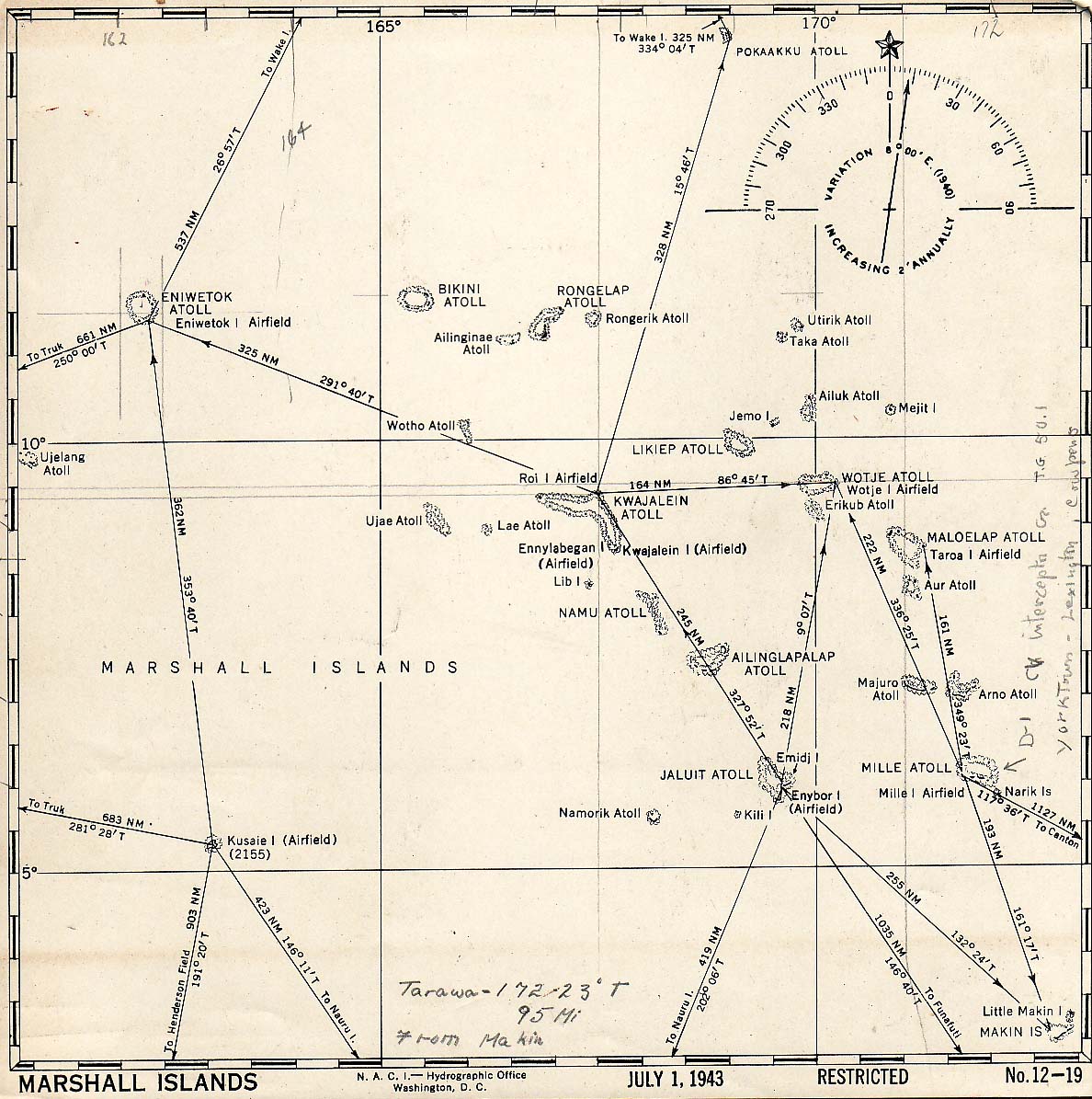
| Caption | United States Hydrographic Office July 1943 map of the Marshall Islands showing distances and bearings between major island groups. ww2dbase | |||||
| WW2-Era Location Name | Marshall Islands | |||||
| Date | Jul 1943 | |||||
| Photographer | Unknown | |||||
| Source Information | ||||||
| Source | ww2dbaseUnited States Hydrographic Office | |||||
| Related Content | ||||||
| More on... |
| |||||
| Licensing Information | ||||||
| Licensing | This work is believed to be in the public domain. Please contact us regarding any inaccuracies with the above information. Thank you. |
|||||
| Metadata | ||||||
| Added By | David Stubblebine | |||||
| Photo Size | 1,188 x 1,195 pixels | |||||
Please consider supporting us on Patreon. Even $1 per month will go a long way! Thank you. Please help us spread the word: Stay updated with WW2DB: |
Search WW2DB

Map
WW2-Era Location Name:Marshall Islands
Latitude-Longitude:
9.0076, 167.3082
Current Site Statistics
- » 1,175 biographies
- » 337 events
- » 44,927 timeline entries
- » 1,245 ships
- » 350 aircraft models
- » 207 vehicle models
- » 376 weapon models
- » 123 historical documents
- » 261 facilities
- » 470 book reviews
- » 28,474 photos
- » 365 maps
Famous WW2 Quote
"I have returned. By the grace of Almighty God, our forces stand again on Philippine soil."General Douglas MacArthur at Leyte, 17 Oct 1944
Support Us
Please consider supporting us on Patreon. Even $1 a month will go a long way. Thank you!
Or, please support us by purchasing some WW2DB merchandise at TeeSpring, Thank you!