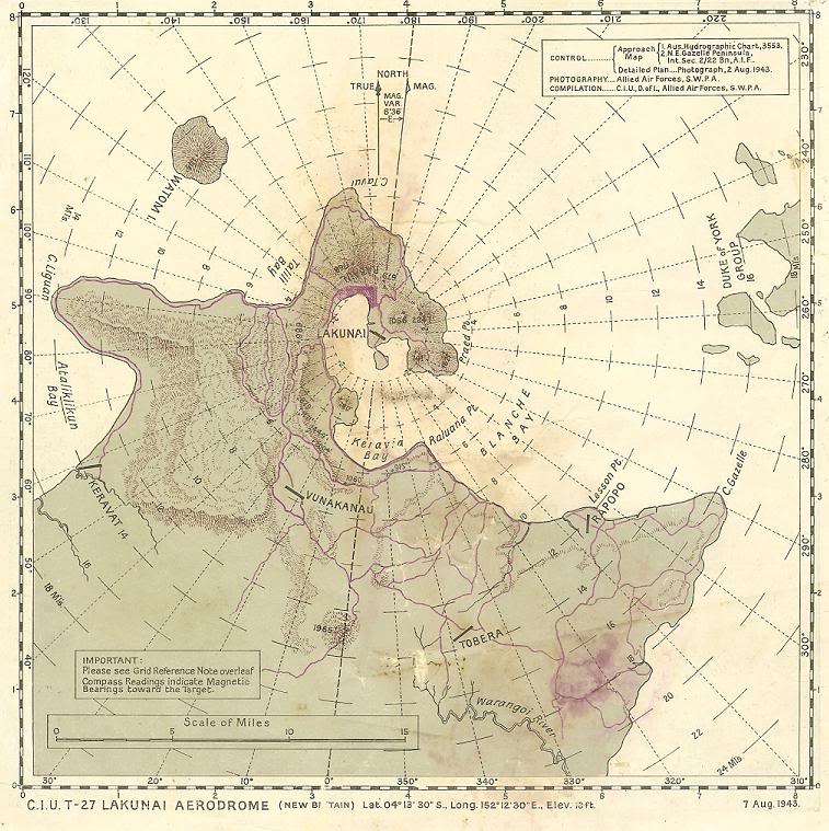
| Caption | Aviation navigational Approach Map to designed guide strike aircraft to Lakunai Aerodrome at Rabaul, New Britain, Bismarck Islands. Map dated Aug 7, 1943. Note other airfields marked on the map. ww2dbase | |||||
| Photographer | Unknown | |||||
| Source | ww2dbaseUnited States National Archives | |||||
| More on... |
| |||||
| Photo Size | 757 x 759 pixels | |||||
| Photos on Same Day | 7 Aug 1943 | |||||
| Photos at Same Place | Rabaul, New Britain, Australian New Guinea | |||||
| Added By | David Stubblebine | |||||
| Licensing | Public Domain. According to the US National Archives, as of 21 Jul 2010: Please contact us regarding any inaccuracies with the above information. Thank you. |
|||||
| Colorized By WW2DB |
Colorized with Adobe Photoshop |
Did you enjoy this photograph or find this photograph helpful? If so, please consider supporting us on Patreon. Even $1 per month will go a long way! Thank you. Share this photograph with your friends: Stay updated with WW2DB: |
Search WW2DB
Modern Day Location
| WW2-Era Place Name | Rabaul, New Britain, Australian New Guinea |
| Lat/Long | -4.2239, 152.1847 |
Random Photograph
Current Site Statistics
- » 1,150 biographies
- » 337 events
- » 43,917 timeline entries
- » 1,241 ships
- » 350 aircraft models
- » 207 vehicle models
- » 375 weapon models
- » 123 historical documents
- » 260 facilities
- » 470 book reviews
- » 28,545 photos
- » 432 maps
Famous WW2 Quote
"All that silly talk about the advance of science and such leaves me cold. Give me peace and a retarded science."Thomas Dodd, late 1945
Support Us
Please consider supporting us on Patreon. Even $1 a month will go a long way. Thank you!
Or, please support us by purchasing some WW2DB merchandise at TeeSpring, Thank you!