| Historical Information | ||||||
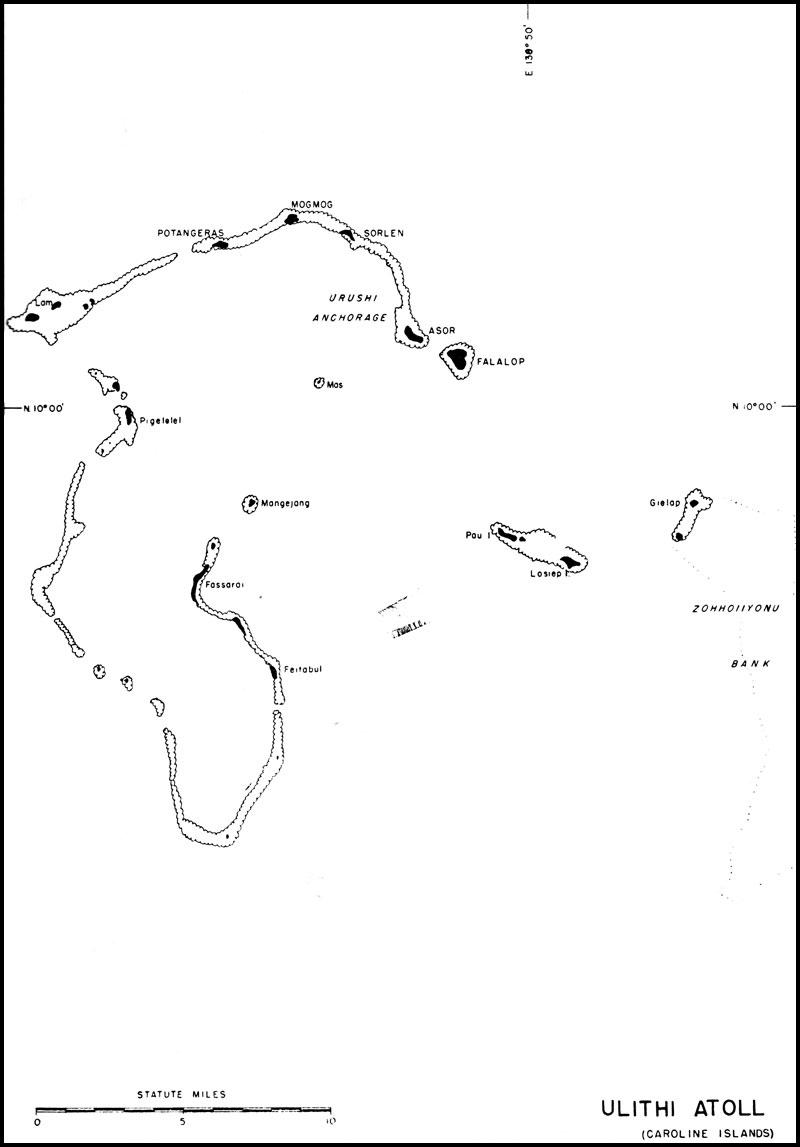
| Caption | Map of Ulithi Atoll, Caroline Islands ww2dbase | |||||
| WW2-Era Location Name | Ulithi, Caroline Islands | |||||
| Date | ||||||
| Photographer | Unknown | |||||
| Source Information | ||||||
| Source | ww2dbaseUnited States National Archives | |||||
| Related Content | ||||||
| More on... |
| |||||
| Colorized By WW2DB |
Colorized with Adobe Photoshop |
|||||
| Licensing Information | ||||||
| Licensing | Public Domain. According to the US National Archives, as of 21 Jul 2010: Please contact us regarding any inaccuracies with the above information. Thank you. |
|||||
| Metadata | ||||||
| Added By | David Stubblebine | |||||
| Photo Size | 800 x 1,147 pixels | |||||
Please consider supporting us on Patreon. Even $1 per month will go a long way! Thank you. Please help us spread the word: Stay updated with WW2DB: |
Search WW2DB
Map
WW2-Era Location Name:Ulithi, Caroline Islands
Latitude-Longitude:
9.9700, 139.6700
Random Photograph
Current Site Statistics
- » 1,169 biographies
- » 337 events
- » 44,828 timeline entries
- » 1,244 ships
- » 350 aircraft models
- » 207 vehicle models
- » 376 weapon models
- » 123 historical documents
- » 261 facilities
- » 470 book reviews
- » 28,515 photos
- » 365 maps
Famous WW2 Quote
"The raising of that flag on Suribachi means a Marine Corps for the next 500 years."James Forrestal, Secretary of the Navy, 23 Feb 1945
Support Us
Please consider supporting us on Patreon. Even $1 a month will go a long way. Thank you!
Or, please support us by purchasing some WW2DB merchandise at TeeSpring, Thank you!