| Historical Information | ||||||
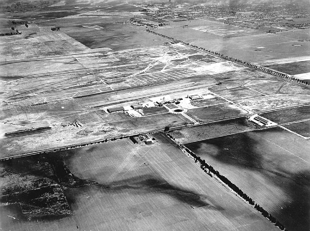
| Caption | Mines Filed, Inglewood, California in the mid-1930s. Hangars No. 1 through 5 can be seen, Hangar No. 1 is on the right. The control tower is between Hangars No. 2 and 3. ww2dbase | |||||
| WW2-Era Location Name | Inglewood, California, United States | |||||
| Date | 1936 | |||||
| Photographer | Unknown | |||||
| Source Information | ||||||
| Source | ww2dbaseLos Angeles World Airports via PCR Services Corporation | |||||
| Link to Source | Link | |||||
| Related Content | ||||||
| More on... |
| |||||
| Licensing Information | ||||||
| Licensing | This work is believed to be in the public domain. Please contact us regarding any inaccuracies with the above information. Thank you. |
|||||
| Metadata | ||||||
| Added By | David Stubblebine | |||||
| Photo Size | 1,080 x 807 pixels | |||||
Please consider supporting us on Patreon. Even $1 per month will go a long way! Thank you. Please help us spread the word: Stay updated with WW2DB: |
Visitor Submitted Comments
All visitor submitted comments are opinions of those making the submissions and do not reflect views of WW2DB.
Search WW2DB

Map
WW2-Era Location Name:Inglewood, California, United States
Latitude-Longitude:
33.9336, -118.3844
Random Photograph
Current Site Statistics
- » 1,182 biographies
- » 337 events
- » 45,115 timeline entries
- » 1,248 ships
- » 350 aircraft models
- » 207 vehicle models
- » 376 weapon models
- » 123 historical documents
- » 261 facilities
- » 470 book reviews
- » 28,413 photos
- » 365 maps
Famous WW2 Quote
"An appeaser is one who feeds a crocodile, hoping it will eat him last."Winston Churchill
Support Us
Please consider supporting us on Patreon. Even $1 a month will go a long way. Thank you!
Or, please support us by purchasing some WW2DB merchandise at TeeSpring, Thank you!
14 Mar 2025 03:05:53 PM
The tree-lined road along the upper right edge of the photo is Redondo Blvd (now Aviation Blvd) and the road across the center is Belleview Blvd (now Imperial Hwy). The tree-lined road up the center of the photo is an unknown street that does not appear on 1930s road maps.