432 items in this album on 22 pages.
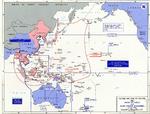 |  | 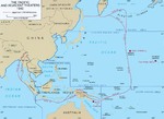 | 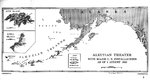 |
| Map noting the boundaries of Allied and Japanese forces as of 2 Jul 1942 | Map marking limit of Axis expansion in Europe, North Africa, and the Atlantic Ocean, Sep 1939-Aug 1942 | Map showing the extent of Japanese advance in 1942 | Map of installations in the Aleutian Island Area as of 1 Aug 1942, prepared for the United States Navy Office of Naval Intelligence Combat Narrative report. Note that Attu and Kiska were listed as Japanese held. |
 |  | 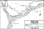 |  |
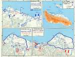
| Track chart from the shelling of Kiska Island by the cruiser USS St. Louis, 7 Aug 1942. | Track of the cruiser night action of 9 Aug 1942 off Savo Island, Solomon Islands where three United States cruisers and one Australian cruiser were lost. Track is taken from the USS Astoria damage report. | Map of the Makin Raid, Makin Island, 17 Aug 1942 | USMC Map 104 showing the northern coast of Guadalcanal in the Lunga area |
 | 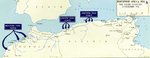 | 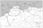 | 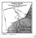 |
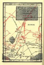
| Map depicting the Guadalcanal Campaign, 7-8 Aug, 12-14 Sep, and 23-26 Oct 1942 | Map showing Operation Torch landings in North Africa, 8 Nov 1942 | Map showing the United States Army landings at Algiers, Algeria, 8 Nov 1942. | Track of Beach Approaches for the Western Task Force during Operation Torch, 8 Nov 1942, prepared for the United States Navy Office of Naval Intelligence Combat Narrative report. |
 |  | 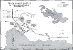 | 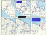 |
| Map depicting Japanese and US Naval movements during the Second Naval Battle of Guadalcanal the night of Nov 14, 1942. | Map depicting Japanese attack and withdraw over the Owen Stanley Range, New Guinea, 18 Sep-15 Nov 1942 | United States Navy Track Chart Battle of Tassafaronga, 30 Nov 1942. Chart created in 1946. | Maps of several New Guinea Campaign engagements, mid- to late-1942 |
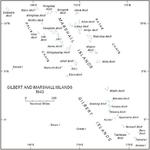 | 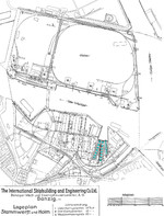 | 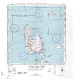 | 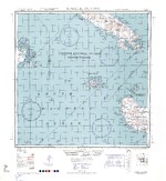 |
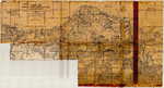
| 1943 map of the Marshall and Gilbert Islands | 1943 plan of Danziger Werft; note three longitudinal slips (highlighted in blue) | 1943 United States Army map of Espiritu Santo in the New Hebrides Islands (now Vanuatu). | 1943 United States Army map of western Guadalcanal and the Russel Islands in the Solomon chain. |
432 items in this album on 22 pages.
Search WW2DB
News
- » WW2DB's 19th Anniversary (29 Dec 2023)
- » Looted Painting "Madonna with Child" Returned to Poland (2 Jun 2023)
- » Wreck of USS Mannert L. Abele Found (29 May 2023)
- » Wreck of Montevideo Maru Found (25 Apr 2023)
- » Accidental Detonation of a WW2-Era Bomb in Great Yarmouth (10 Feb 2023)
- » See all news
Current Site Statistics
- » 1,150 biographies
- » 337 events
- » 43,556 timeline entries
- » 1,238 ships
- » 349 aircraft models
- » 207 vehicle models
- » 372 weapon models
- » 123 historical documents
- » 259 facilities
- » 468 book reviews
- » 28,412 photos
- » 432 maps
Famous WW2 Quote
"Among the men who fought on Iwo Jima, uncommon valor was a common virtue."Fleet Admiral Chester W. Nimitz, 16 Mar 1945
Support Us
Please consider supporting us on Patreon. Even $1 a month will go a long way. Thank you!
Or, please support us by purchasing some WW2DB merchandise at TeeSpring, Thank you!