432 items in this album on 22 pages.
 |  | 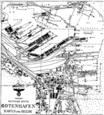 | 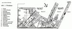 |
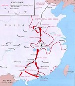
| Map of northern Burma, late 1943-early 1944 | Map of situation in India and Burma, Nov 1943-May 1944 | Shipyard plan for Deutsche Werke Gotenhafen, Gdynia, occupied Poland, 1944 | Shipyard plan for Deutsche Werke Gotenhafen, Gdynia, occupied Poland, circa 1944 |
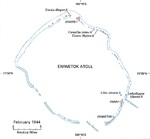 | 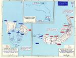 |  |  |
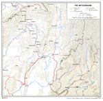
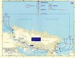
| Feb 1944 United States Army map of Eniwetok Atoll in the Marshall Islands. | Map depicting the invasion of Kwajalein Atoll, Marshall Islands, 31 Jan-4 Feb 1944 | Map of the Battle of the North Cape, 26 Dec 1943 as published in the Feb 1944 issue of the US Navy’s All Hands magazine. | Map of Allied force dispositions at Anzio, Italy, 1 Feb 1944 |
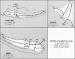 | 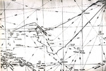 |  |  |
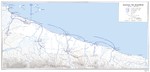
| Map illustrating Operation Catchpole against Eniwetok, Engebi, and Parry Islands of Eniwetok Atoll, Marshall Islands, 18-22 Feb 1944 | US Navy map of the central Pacific showing USS Intrepid’s track from 16 Jan to 24 Feb 1944 from Pearl Harbor and back, including the 16 Feb 1944 raid on Truk Atoll (not Chuuk), Caroline Islands. | Hand-drawn map of Guadalcanal, 6 Mar 1944 | Map of eastern New Guinea showing Allied troops movements relating to the Hollandia-Aitape landings, Apr 1944. |
 |  |  | 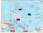 |
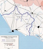
| Map depicting movements for Operation Ichigo, mid-Apr 1944 | Map depicting the invasion of Hollandia, New Guinea, 22-26 Apr 1944 | United States Army map of the invasion beachhead at Aitape, New Guinea depicting the progress after the landings of 23 Apr 1944. | Map depicting Operation Cartwheel and the invasion of Gilbert and Marshall Islands, 30 Jun 1943-26 Apr 1944 |
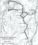 | 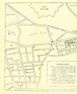 | 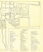 | 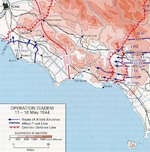 |
| Map depicting the movement of Allied H, K, and M forces toward Myitkyina, Burma, 28 Apr to 16 May 1944 | American Red Cross pamphlet 'Guide to Calcutta', May 1944, map 1 of 2 | American Red Cross pamphlet 'Guide to Calcutta', May 1944, map 2 of 2 | Map of the Allied Operation Diadem plan for the Anzio, Italy area, May 1944 |
432 items in this album on 22 pages.
Search WW2DB
News
- » WW2DB's 19th Anniversary (29 Dec 2023)
- » Looted Painting "Madonna with Child" Returned to Poland (2 Jun 2023)
- » Wreck of USS Mannert L. Abele Found (29 May 2023)
- » Wreck of Montevideo Maru Found (25 Apr 2023)
- » Accidental Detonation of a WW2-Era Bomb in Great Yarmouth (10 Feb 2023)
- » See all news
Current Site Statistics
- » 1,150 biographies
- » 337 events
- » 43,556 timeline entries
- » 1,239 ships
- » 349 aircraft models
- » 207 vehicle models
- » 372 weapon models
- » 123 historical documents
- » 259 facilities
- » 468 book reviews
- » 28,413 photos
- » 432 maps
Famous WW2 Quote
"No bastard ever won a war by dying for his country. You win the war by making the other poor dumb bastard die for his country!"George Patton, 31 May 1944
Support Us
Please consider supporting us on Patreon. Even $1 a month will go a long way. Thank you!
Or, please support us by purchasing some WW2DB merchandise at TeeSpring, Thank you!