432 items in this album on 22 pages.
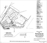 | 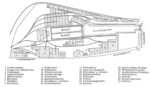 |  | 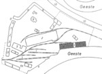 |
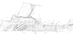
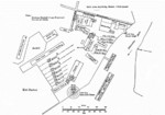
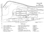
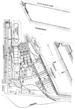
| Plan of Nordseewerke shipyard in Emden, Germany, 10 Jan 1905 | Drawing of the planned layout of the Seebeckwerft shipyard at the GeestemĂĽnde Handelshafen basin, Bremerhaven, Germany, 1906; seen in a business proposal | Georg Dietrich Seebeck's hand-drawn planned layout of the Seebeckwerft shipyard at the GeestemĂĽnde Handelshafen basin, Bremerhaven, Germany, 1906; seen in a business proposal | Shipyard modernization plan of Rickmers shipyard, Bremerhaven, Germany, drawn in 1906 |
 |  |  |  |
| Bremer Vulkan shipyard drawing, 1907 | Plan of Howaldtswerke Kiel shipyard, 1907; the year 1907 could not be verified because the texts such as slip dimensions were added much later | Plan of Seebeckwerft shipyard, Bremerhaven, Germany, 1906-1907 | Plan of Howaldtswerke Kiel shipyard, 1909 |
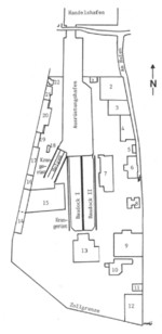 | 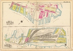 | 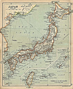 |  |
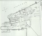
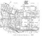
| Plan of the Seebeckwerft shipyard at the GeestemĂĽnde Handelshafen basin, Bremerhaven, Germany, 1906-1910 | 1912 map showing the two sections of piers comprising the Boston Navy Yard. | Map of Japan seen in 'A Literary and Historical Atlas of Asia' by J. G. Bartholomew. J. M. Dent and Sons, Ltd. printed in 1912; note inclusion of Taiwan within Japanese borders | Plan of Neptun Schiffswerft und Maschinenfabrik, Rostock, Germany, circa 1910s |
 | 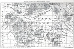 |  | 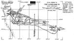 |
| Plan of Vulcan shipyard (later Howaldtswerke), Hamburg, Germany, circa 1918 | 1919 British Admiralty chart of Scapa Flow, Orkney Islands, Scotland, United Kingdom. | Plan of Vulcan shipyard (later Howaldtswerke), Hamburg, Germany, 1919 | Diagram of the coastal batteries of Fort Kamehameha along the eastern shore of the Pearl Harbor channel opening, Oahu, Hawaii, 1922. |
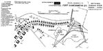 | 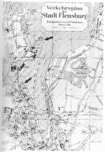 | 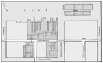 |  |
| Plan of the western end of Fort Kamehameha at the entrance to Pearl Harbor, Oahu, Hawaii, 19 Jan 1922. | Map of Flensburg, Germany, circa 1925; note Flensburger Schiffbau old shipyard (alte-werft) and new shipyard (neue-werft) marked with arrows | Plan of H. C. StĂĽlcken Sohn shipyard of Hamburg, Germany, 1925 | Map of Deutsche Werke Kiel, Germany, 1928 |
432 items in this album on 22 pages.
Search WW2DB
News
- » WW2DB's 19th Anniversary (29 Dec 2023)
- » Looted Painting "Madonna with Child" Returned to Poland (2 Jun 2023)
- » Wreck of USS Mannert L. Abele Found (29 May 2023)
- » Wreck of Montevideo Maru Found (25 Apr 2023)
- » Accidental Detonation of a WW2-Era Bomb in Great Yarmouth (10 Feb 2023)
- » See all news
Random Photograph
Current Site Statistics
- » 1,150 biographies
- » 337 events
- » 43,556 timeline entries
- » 1,238 ships
- » 349 aircraft models
- » 207 vehicle models
- » 372 weapon models
- » 123 historical documents
- » 259 facilities
- » 468 book reviews
- » 28,415 photos
- » 432 maps
Famous WW2 Quote
"An appeaser is one who feeds a crocodile, hoping it will eat him last."Winston Churchill
Support Us
Please consider supporting us on Patreon. Even $1 a month will go a long way. Thank you!
Or, please support us by purchasing some WW2DB merchandise at TeeSpring, Thank you!