365 items in this album on 19 pages.
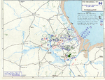 | 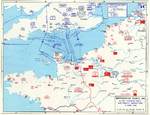 |  | 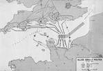 |
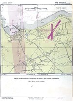
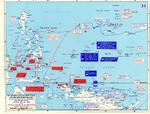
| Map depicting the Utah beachhead, Normandy, France, 6 Jun 1944 | Map noting Allied and German dispositions in southern England, United Kingdom and Normandy, France on 6 Jun 1944 | Map noting situation at Normandy, France at 2400 hours on 6 Jun 1944; note title text with deceptive American unit FUSAG | Map of Allied assault routes at Normandie, France, 6 Jun 1944 |
 |  | 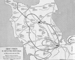 | 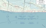 |
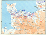
| Map of Juno Beach Normandy, France showing 3rd Canadian Infantry Division D-Day landing objectives and front line as of midnight 6 Jun 1944. | Map of the Omaha beachhead, Normandy, France, showing movements of the US Army V Corps, 6 Jun 1944 | Map showing German dispositions on Cotentin Peninsula in France on 6 Jun 1944 | US Army map of the landing beaches at Utah Beach, Normandy, France, 6 Jun 1944. Note that the planned landing beaches are about 250 yards away from actual landing beaches. |
 |  |  |  |
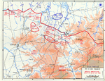
| Map depicting Allied operations in the Normandy, France area, 13-30 Jun 1944 | Map of the Battle of Saipan Jun 15 through July 9, 1944 | Map depicting the Salween Offensive, 11 May-30 Jun 1944 | Jul 1944 United States Navy Landing Chart for Kahului Naval Air Station on Maui, Hawaii. |
 | 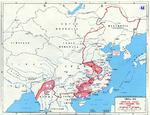 |  |  |
| Map detailing Allied advances in New Guinea and the Mariana Islands, 22 Apr-24 Jul 1944 | Map of the Japanese Operation Ichigo offensive in China, Apr-Dec 1944 | Map showing Allied advance from Rome toward the Arno River, Italy, 5 Jun-5 Aug 1944 | Aviation Approach Chart for Naval Air Station Kahului, Maui, US Territory of Hawaii, dated 1 Jul 1944 |
 |  |  |  |
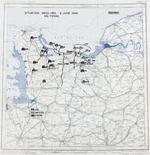
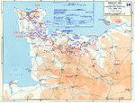
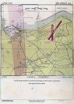
| Aviation Approach Chart for Naval Air Station Kaneohe, Oahu, US Territory of Hawaii, dated 1 Jul 1944 | Oahu Air Traffic Plan, Jul 15, 1944. | Map depicting the Allied attempt to expand the beachhead at Normandy, France, 1-24 Jul 1944 | Map depicting the situation near Saint-Lô, France during the night of 24-25 Jul 1944 |
365 items in this album on 19 pages.
Search WW2DB
News
- » US Women's Army Corps "Six Triple Eight" Awarded with Congressional Gold Medal (30 Apr 2025)
- » Wreck of Soviet Submarine M-49 Found (10 Apr 2025)
- » Japanese Emperor Visited Iwoto (Iwo Jima) (8 Apr 2025)
- » Race, Holocaust, and African-American WW2 Histories Removed from the US Naval Academy Library (7 Apr 2025)
- » US Government Plans to Purge WW2 Information (17 Mar 2025)
- » See all news
Current Site Statistics
- » 1,167 biographies
- » 337 events
- » 44,614 timeline entries
- » 1,244 ships
- » 350 aircraft models
- » 207 vehicle models
- » 376 weapon models
- » 123 historical documents
- » 261 facilities
- » 470 book reviews
- » 28,515 photos
- » 365 maps
Famous WW2 Quote
"The raising of that flag on Suribachi means a Marine Corps for the next 500 years."James Forrestal, Secretary of the Navy, 23 Feb 1945
Support Us
Please consider supporting us on Patreon. Even $1 a month will go a long way. Thank you!
Or, please support us by purchasing some WW2DB merchandise at TeeSpring, Thank you!