365 items in this album on 19 pages.
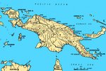 | 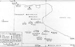 | 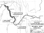 | 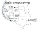 |
| Map of New Guinea, showing major coastal strategic regions of the 1940s | Map of the Foggia Aerodrome complex showing the USAAF 15th Air Force units assigned to each airstrip | Map showing the fuel pipelines built along the Ledo (Stilwell) Road from Assam, India through Burma (now Myanmar) to Kunming, China, 1945. | Map showing the locations of all ten Relocation Centers for deported Japanese-Americans with figures showing each camp’s maximum population during the war. |
 | 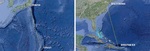 | 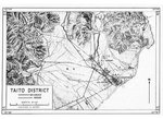 |  |
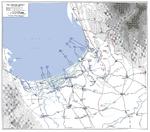
| Map showing wartime track of USS Intrepid | Maps comparing the routes between Tinian and Tokyo and between Borinquen Field, Puerto Rico and Baltimore, Maryland, United States. | United States Army adaptation of a Japanese map of the Taitō District (now Taitung) on the east coast of Taiwan. | United States Army Air Force map of Taiwan. |
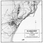 |  |  |  |
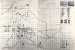
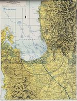
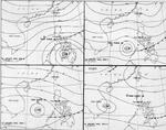
| United States Army map of the Karenko District (now Hualien) on the east coast of Taiwan. | Post-mission map of the Air Group 80 of USS Ticonderoga 3 Jan 1945 attack on Taichu Airfield, central Taiwan | Map showing American troops reclaiming territory lost during early days of the Battle of the Bulge, 26 Dec 1944-5 Jan 1945 | Four-part weather map of the South China Sea for Jan 7 to 10, 1945. Note daily positions of Task Force 38. |
 |  |  |  |
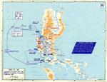
| Hand-drawn map of Air Group 80 of USS Ticonderoga 9 Jan 1945 attack on Heito Airfield, southern Taiwan | Map of landing beaches in Lingayen Gulf, Luzon, Philippine Islands, 9 Jan 1945 | United States Army operations map of Lingayen Gulf, Luzon, Philippines showing the Landing beaches for the 9 Jan 1945 landings. | Four-part weather map of the South China Sea for Jan 11 to 14, 1945. Note daily positions of Task Force 38. |
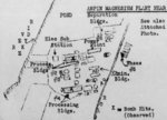 |  | 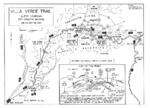 |  |
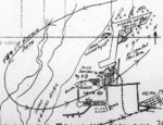
| Hand-drawn post-raid map of Kaneka Soda Company chemical plant (mis-identified as a magnesium plant) by personnel of Air Group 80 aboard USS Ticonderoga, 15 Jan 1945 or later; the facilities were located in Anpin District, Tainan, Taiwan | Map depicting the Salween Offensive in southern China and northern Burma, 3 Nov 1944-27 Jan 1945 | Map of the Villa Verde trail used by the US 32nd Infantry Division during the Luzon Campaign, Jan 30 through May 28, 1945 | Map of the American campaign on Luzon, Philippine Islands, 9 Jan-4 Feb 1945 |
365 items in this album on 19 pages.
Search WW2DB

News
- » US State Lawmaker John Winter Caught Using Racial Slur "Jap" and Apologized (11 Jun 2025)
- » Köln/Cologne Evacuated After Discovery of WW2 Bombs (4 Jun 2025)
- » US Women's Army Corps "Six Triple Eight" Awarded with Congressional Gold Medal (30 Apr 2025)
- » Race, Holocaust, and African-American WW2 Histories Removed from the US Naval Academy Library (7 Apr 2025)
- » US Government Plans to Purge WW2 Information (17 Mar 2025)
- » See all news
Current Site Statistics
- » 1,177 biographies
- » 337 events
- » 44,933 timeline entries
- » 1,245 ships
- » 350 aircraft models
- » 207 vehicle models
- » 376 weapon models
- » 123 historical documents
- » 261 facilities
- » 470 book reviews
- » 28,476 photos
- » 365 maps
Famous WW2 Quote
"You ask, what is our aim? I can answer in one word. It is victory. Victory at all costs. Victory in spite of all terrors. Victory, however long and hard the road may be, for without victory there is no survival."Winston Churchill
Support Us
Please consider supporting us on Patreon. Even $1 a month will go a long way. Thank you!
Or, please support us by purchasing some WW2DB merchandise at TeeSpring, Thank you!