Manzanar War Relocation Center
| Type | 250 Prison Camp | |
| Historical Name of Location | Manzanar, California, United States | |
| Coordinates | 36.728333000, -118.154444000 |
Contributor: David Stubblebine
ww2dbaseThe relocation center for Japanese-American detainees at Manzanar, Inyo County, California was one of the best known of the World War II detention camps. The camp was located in California's Owens Valley about 230 miles north of Los Angeles near the Nevada border east of the Sierra Nevada mountains.
ww2dbaseFrom the earliest times, this valley was inhabited by the native Eastern Mono people. In the mid-1800s, settlers of European ancestry began ranching in the region and successfully developed the area for apple production (in Spanish, "manzanar" means apple orchard). In the early 1900s, the City of Los Angeles began buying up all of the water rights in the valley and diverted all the water south by aqueduct, including the ground water brought up through wells. By the mid-1930s, with the water gone, the area turned into a desert and apple production collapsed. When property values also collapsed, the City of Los Angeles began buying up the land outright and soon owned most of the Owens Valley.
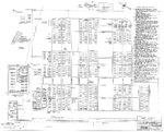
ww2dbaseWith the outbreak of World War II and President Roosevelt's signing of Executive Order 9066, the Army leased almost 10 square miles in the Owens Valley across the highway from the Manzanar Airstrip. Under the direction of the Corps of Engineers, one square mile of that plot was developed into the internment camp. The camp had a grid of 36 blocks and each block had 16 barrack buildings, a central mess hall, laundry and bath house, and latrines for men and women. The camp also had central kitchens, a hospital, canteens, schools, and limited recreational facilities. Like all of the relocation centers, the perimeter was marked with a high, barbed wire fence that was overlooked all the way around by guard towers where armed Army Military Police troops were always on duty.
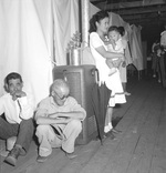
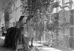
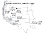
ww2dbaseBeginning in Mar 1942, Japanese American detainees began arriving. Most were from the Los Angeles area with the remainder from California's Central Valley and Washington state. At its peak, Manzanar held 10,046 adults and children in one square mile, which was about average for the ten relocation centers and three times the population density of Los Angeles at the time. Conditions at the camp were harsh. The buildings were simple wood plank construction with exteriors covered in tarpaper. These structures offered some protection against the wind but almost none against the bitter cold in winter or the blazing heat in summer. Food was meager and rarely things the internees were accustomed to eating, but the residents did their best to also cultivate potatoes and other vegetables. One of the main recreational activities was baseball and the camp sported 80 teams at one point.
ww2dbaseManzanar's director, Ralph Merritt, happened to be friends with renown landscape photographer Ansel Adams and in 1943, he invited Adams to visit the camp. Adams accepted and his photo collection has since become central parts of the Library of Congress and National Park Service histories of the camp. Adams was instructed to not photograph the barbed wire or the guard towers but with his unique eye, he still managed to capture several of the ironies around the camp. Adams thought the entire concept of Japanese internment was improper and before the war ended, he published many of his Manzanar photos in his book Born Free and Equal that was a strong witness to the injustices connected with incarcerating American citizens without charges or due process.
ww2dbaseManzanar closed on 21 Nov 1945 after more than three years of operation. The only reason the camp remained open that long was because by that time many of the internees did not have homes to return to and with nowhere else to go, they stayed at Manzanar. Certainly, security was no longer an issue since the guards stopped manning the towers or enforcing the perimeter in 1944. In the end, a few residents had to be forcibly evicted from the camp at the time the facility was finally being closed.
ww2dbaseAfter the camp's closure, the improvements, such as they were, were dismantled and what remained was quickly reclaimed by the desert with only a few buildings surviving. The area today is protected as a National Historic Site and a California Historical Landmark. Former Manzanar internees have made annual pilgrimages of remembrance back to the site for many years following the camp's closure.
ww2dbaseSources:
National Archives
Library of Congress
Japanese American Citizens League
Skirball Cultural Center
California State Parks Commission
The Atlantic – Ansel Adams's Subversive Images of Japanese Internment
County of Inyo, Eastern California Museum
Military History and Museums Program
Abandoned and Little Known Airfields by Paul Freeman
Wikipedia
Last Major Update: Jan 2020
Manzanar War Relocation Center Interactive Map
Photographs
 |  |  |  |
Maps
 |  |  |
Please consider supporting us on Patreon. Even $1 per month will go a long way! Thank you. Please help us spread the word: Stay updated with WW2DB: |
| WW2-Era Place Name | Manzanar, California, United States |
| Lat/Long | 36.7283, -118.1544 |
 |
- » 1,167 biographies
- » 337 events
- » 44,606 timeline entries
- » 1,243 ships
- » 350 aircraft models
- » 207 vehicle models
- » 376 weapon models
- » 123 historical documents
- » 261 facilities
- » 470 book reviews
- » 28,501 photos
- » 365 maps
Winston Churchill, on the RAF
Please consider supporting us on Patreon. Even $1 a month will go a long way. Thank you!
Or, please support us by purchasing some WW2DB merchandise at TeeSpring, Thank you!