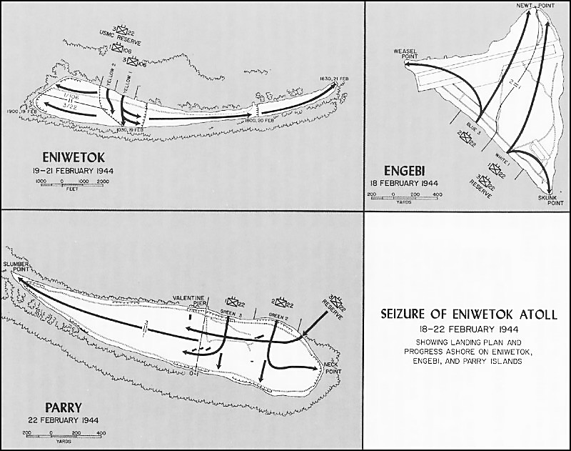
| Caption | Map illustrating Operation Catchpole against Eniwetok, Engebi, and Parry Islands of Eniwetok Atoll, Marshall Islands, 18-22 Feb 1944 ww2dbase | |||||
| Photographer | Unknown | |||||
| Source | ww2dbaseWikimedia Commons | |||||
| Link to Source | Link | |||||
| More on... |
| |||||
| Photo Size | 800 x 631 pixels | |||||
| Photos on Same Day | 22 Feb 1944 | |||||
| Photos at Same Place | Marshall Islands | |||||
| Added By | C. Peter Chen | |||||
| Licensing | This work is believed to be in the public domain. Please contact us regarding any inaccuracies with the above information. Thank you. |
Did you enjoy this photograph or find this photograph helpful? If so, please consider supporting us on Patreon. Even $1 per month will go a long way! Thank you. Share this photograph with your friends: Stay updated with WW2DB: |
Search WW2DB
News
- » Wreck of USS Edsall Found (14 Nov 2024)
- » Autumn 2024 Fundraiser (7 Nov 2024)
- » Nobel Peace Prize for the Atomic Bomb Survivors Organization (11 Oct 2024)
- » Wreck of USS Stewart/DD-224 Found (2 Oct 2024)
- » See all news
Current Site Statistics
- » 1,150 biographies
- » 337 events
- » 43,917 timeline entries
- » 1,241 ships
- » 350 aircraft models
- » 207 vehicle models
- » 374 weapon models
- » 123 historical documents
- » 260 facilities
- » 470 book reviews
- » 28,542 photos
- » 432 maps
Famous WW2 Quote
"Since peace is now beyond hope, we can but fight to the end."Chiang Kaishek, 31 Jul 1937
Support Us
Please consider supporting us on Patreon. Even $1 a month will go a long way. Thank you!
Or, please support us by purchasing some WW2DB merchandise at TeeSpring, Thank you!